Skip to content Skip to footer

The Duke’s Plan: Description of the Towne of Mannados, or New Amsterdam, Longe Iseland, as it was in September 1665. Valentine’s Manual of the Corporation of City of New York, 1859, NYC Municipal Library.
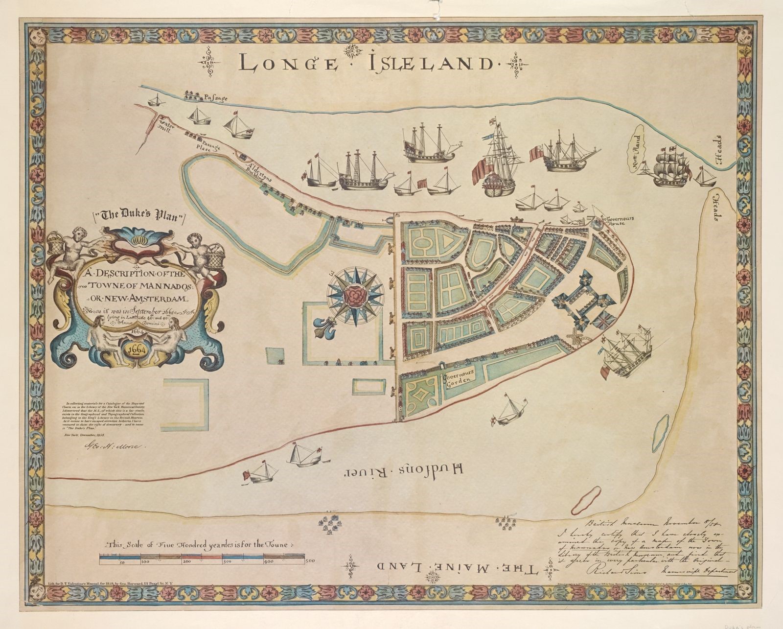
Colorful decorative map with ornate border that reads Longe Isleand on top. The map features large detailed ships at harbor and the outline of the city, The map uses green to denote garden areas and there is a prominent large compass rose in the center of the drawing.

*The spelling of placenames reflects the original spelling used in the document.

Stay in the know. Get updates from NYC’s archives.

NYC's Story: The City On Record​

The Department of Records & Information Services preserves and provides public access to historical and contemporary records and information about NYC government.

More About DORIS

Find out more about the NYC Department of Records at: nyc.gov/records

Any person who believes that inclusion of an item on this site violates his or her exclusive rights should notify us by contacting the designated agent in compliance with the Digital Millennium Copyright Act DMCA. Before using any images from this site, please review our Terms and Conditions.

© 2026. NYC Department of Records. All Rights Reserved.

What do you think?

What would you like to see more of in our exhibit?